 |
Wind continues to severely erode CRP land after wild fire. Photo taken 19 March 1996 in Meade County, Kansas by Skidmore, USDA. |
 |
Eroding soil covers road and fills in shoulder. |
 |
Eroding soil covers road and fills in shoulder. |
 |
Blowing soil reduced visibility to near zero on Highway 34 near Otis,
Washington County, Colorado. Photo taken 25 April 1996 by Skidmore, USDA-ARS Wind Erosion Research Unit. |
 |
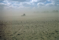
A farmer works his field as the soil blows. |
 |
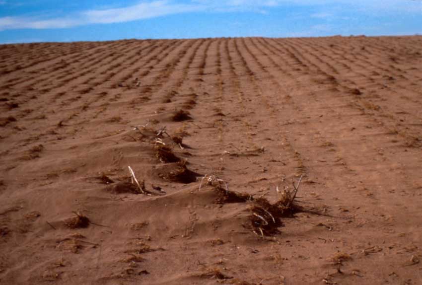
Eroding soil filling furrows and is trapped by surface cover. |
 |
CRP land which had burned then was severely eroded by wind. |
 |
An eroding field. |
 |
Blown out wheat field was source of soil piled against round bales of straw. Photo taken in Pratt County, Kansas, 18 March 1996 (Skidmore, Wind Erosion Research, USDA). |
 |
Soil was blown from adjacent field that had been seeded to wheat. Photo
taken in Pratt County, Kansas, 18 March 1996 (Skidmore, Wind Erosion Research, USDA).
|
 |
Saltation drift on the edge of a wheat field. Note the dunes beginning to form. Dickinson County, Kansas. Photograph taken March 1996, (Skidmore, Wind Erosion Research, USDA). |
 |
Soil is caught in the cover along the edge of a field. |
 |
Concrete irrigation ditch filled with wind-borne sediments. Photo taken just west of Masters, Colorado, 25 April 1996 (Skidmore). |
 |
Soil from the smooth field has been caught in the neighboring
field which offers cover. |
 |
Soil from the smooth field has been deposited downwind by residue cover. |
 |
A field erodes after a burn removes the vegetation. |
 |
Crop is left to die from the effects of wind erosion. |
 |
About three inches of sandy soil was blown away on CRP land by same
wind that fueled fire. This three inches of soil loss occurred during one storm. Photo taken Spring, 1996 in Meade County, Kansas by E. L. Skidmore,
Wind Erosion Research, USDA. |
 |
A sledge hammer is covered during a field experiment showing the soil movement. |
 |
Soil was blown from adjacent field that had been seeded to wheat. Photo
taken in Pratt County, Kansas, 18 March 1996 (Skidmore, Wind Erosion Research, USDA).
|
 |
Lookout point
on Tuttle Creek Lake dam on a dusty day, Spring, 1996. Photo by
Skidmore, USDA. |
 |
Lookout point
at Tuttle Creek Lake dam on a clear day, Spring, 1996.
Photo by Skidmore, USDA. |
 |
Roots have been uncovered
by wind after a fire removed the vegetative cover. Note the burn marks which indicate the soil surface
height before wind erosion occurred. |
 |
About three inches of sandy soil was blown away by same wind that
fueled wild fire. Photo taken February 1996 in Meade County, Kansas by Skidmore, USDA. |
 |
Roots have
been covered by several inches of wind blown soil. |
 |
Plants are smothered by wind blown soil. |
 |
Plants are smothered by wind blown soil. |
 |
Plants find
light through the cracks in the wind blown soil that covers them.
|
 |
Crop is left
to die from the effects of wind erosion. |
 |
Wind erosion leaves behind a small hill. |
 |
Strong north
wind blew snow onto field then soil from adjacent wheat field. Snow and soil deposited on the lee side of an Osage Orange windbreak.
Photo taken 13 February 1996 in Pawnee County, Kansas by Skidmore, USDA-ARS Wind Erosion Research Unit.
|
 |
An eroding
field is sprayed with an experimental substance in hope that it will slow the erosion. |
 |
A dust cloud builds in the background. |
 |
A dust cloud builds in the background and begins to overtake the tree. |


